Dimensions: 7’ x 15’ (Map); 24” x 24” (Squares)
Materials: Graphite on Tyvek (Map); organic cotton, hemp and Tencel (Squares)
Date: 2010
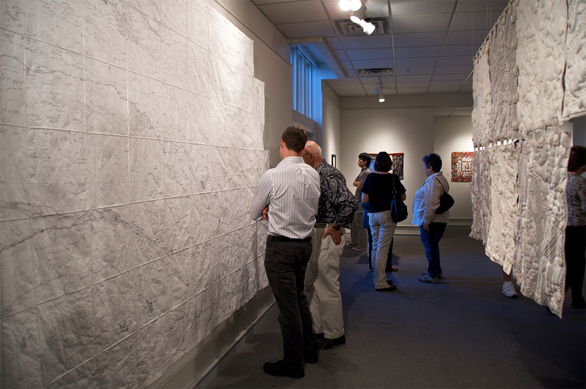
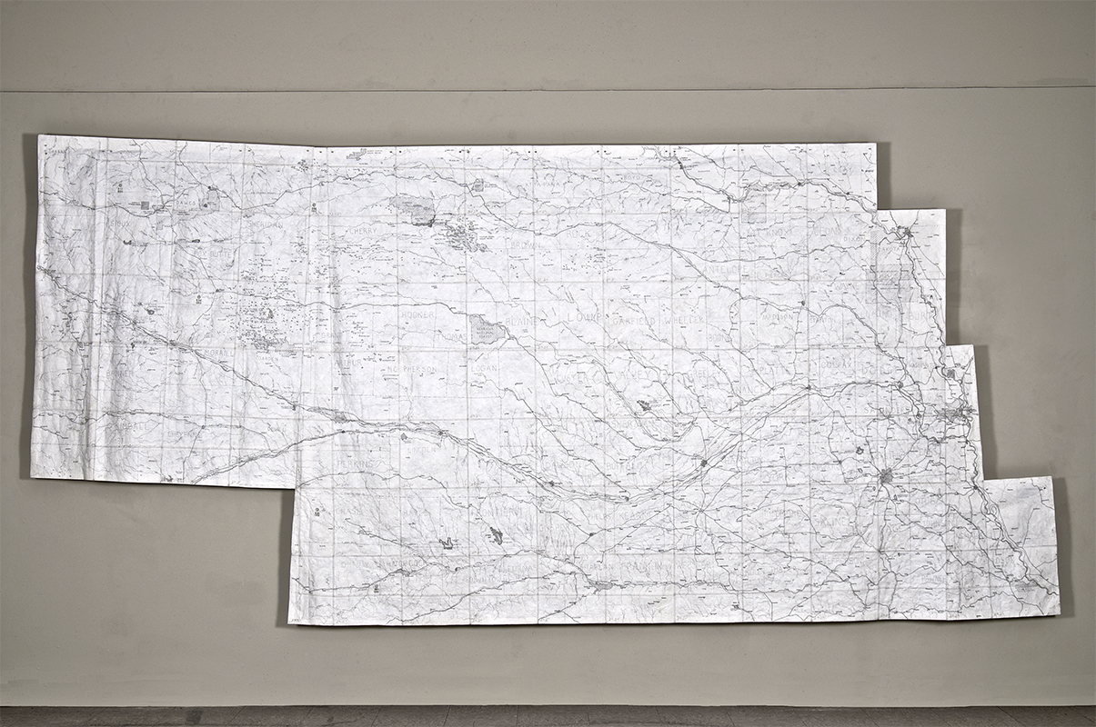
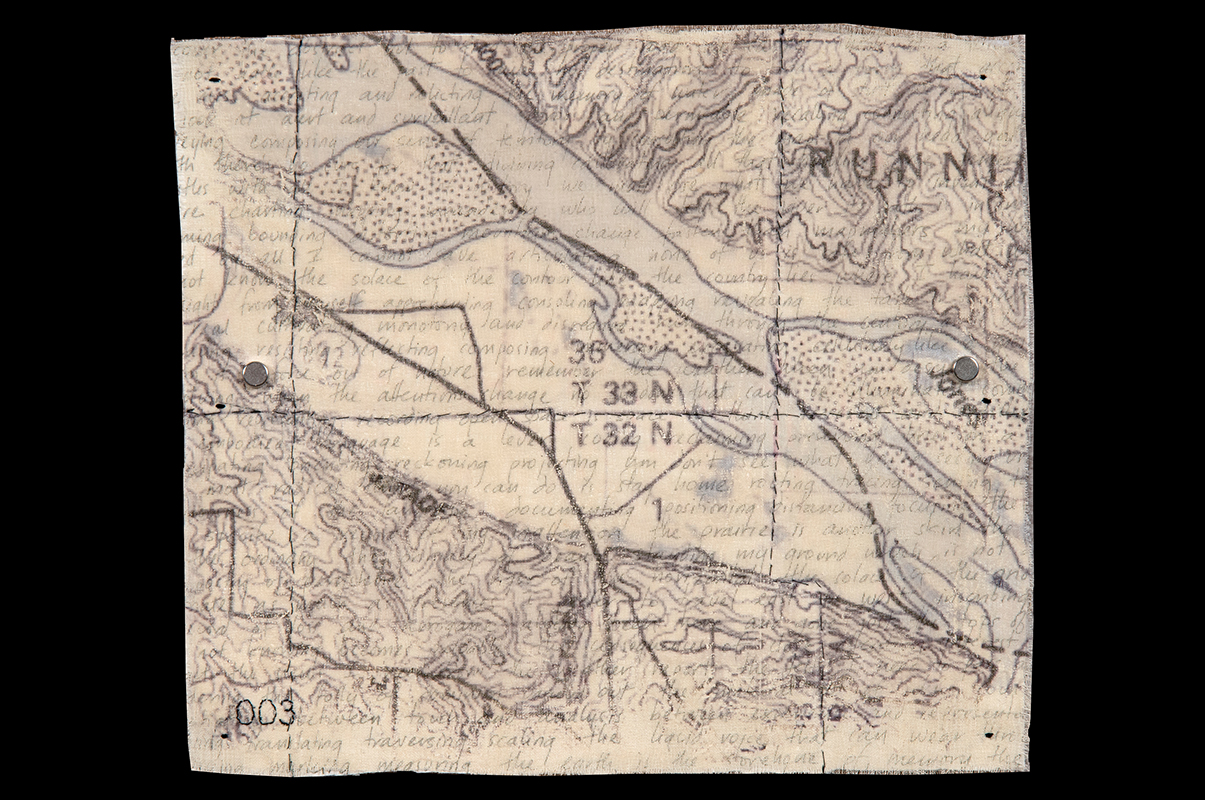
Installation view of my hand-drawn Locator Map of Nebraska (95 sections stitched together) and seven quilted relief Terrain Squares showing the physical terrain of Nebraska at selected locations. The scale of the Locator Map is 1 inch = 2.75 miles. I wanted to stitch the physical topography of Nebraska but I needed to know what I was stitching and where it was located. I wanted to see all of Nebraska’s towns in relation to one another, and because the map I needed was larger than any I could buy I decided to make my own.
Dimensions: 7' x 15'
Materials: Graphite on Tyvek; custom wooden wall mounts
Date: 2010
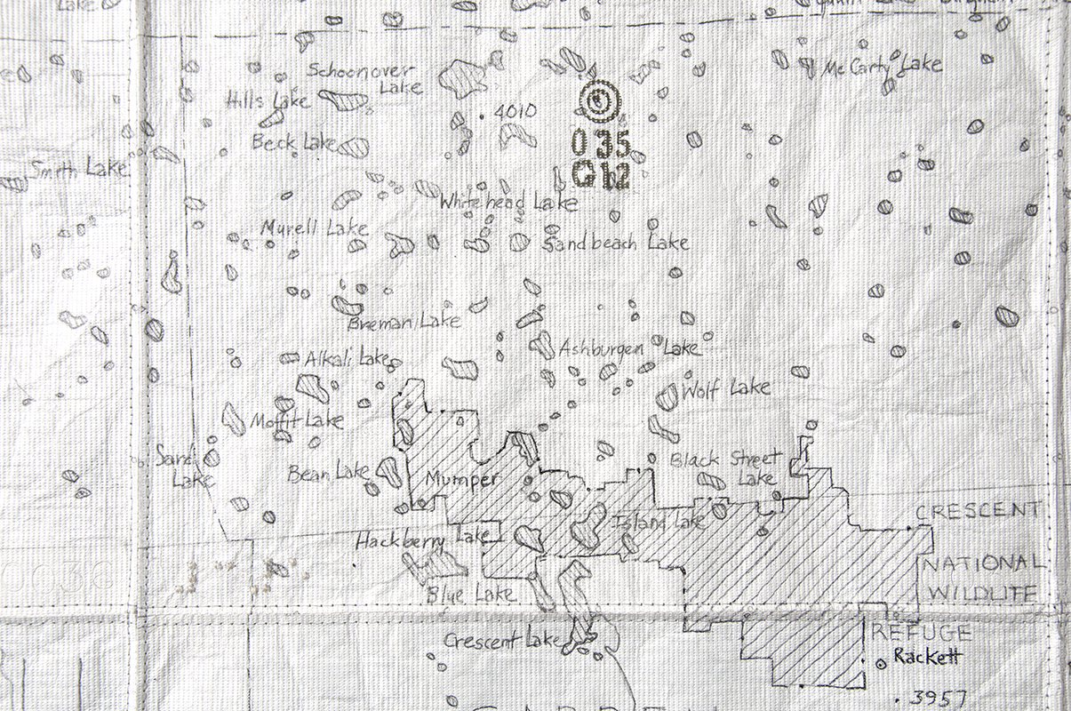
I used topographic software to divide Nebraska into a “Liz Grid” of 95 sections, 33 miles square. I printed each section at 4” square and then drew every city, town, park, railroad, river and creek on 12” Tyvek squares using graphite pencils. At each end of the state, trapezoidal sections (identified with an “A”) reflect the curvature of the earth.
Dimensions: 12” x 12”
Materials: Graphite on Tyvek
Date: 2010
I drew with graphite because of its soft grays and also because it has the same root—graphein or “to write”—as the word “cartography.” I chose Tyvek, a non-woven fabric, because of its industrial associations and also because it recalls the silk of ancient Chinese maps. The 95 section numbers are blind-stamped and also embroidered in Braille. A stamped graphic shows the location of a quilted Terrain Square.
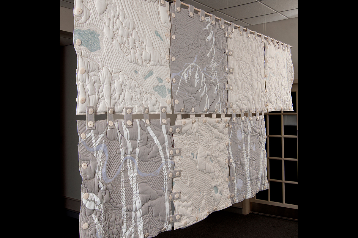
Dimensions: 4' x 8’ x 1” (connected squares); squares are 24” x 24”
Materials: Organic cotton, hemp and Tencel; machine embroidery and hand-stenciling
Date:
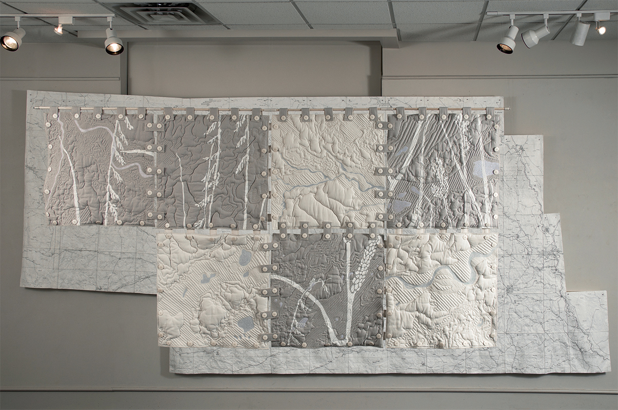
Seven Terrain Squares in installation. The Terrain Squares represent the physical terrain of selected locations at a larger scale (1” = 596) than the Locator Map. I use topographic software to be able to see the terrain at this scale.
Dimensions: 4' x 8’ x 1” (connected squares); squares are 24” x 24”
Materials: Organic cotton, hemp and Tencel; machine embroidery and hand-stenciling
Date: 2010
I translate the physical terrain using free motion stitching and a type of padded relief known as trapunto. I am using, but extending, the conventions of quilting and embroidery.
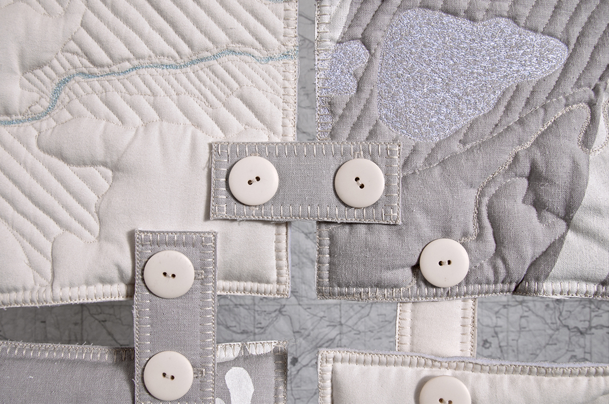
Dimensions: Tabs are 1.5” x 3.75” and are reversible
Materials: 40 buttons and 20 tabs per Terrain Square
Date: 2010
The Terrain Squares fasten together in any order with a system of buttons and tabs which reference the grid marks of the hand-drawn Locator Map. These tabs and buttons, which are decorative as well as functional, recall the domestic uses of quilting and embroidery and contrast with the abstract language of the map. Squares can be hung from the ceiling allowing access to both sides, and I invite the viewer to touch this physical terrain.
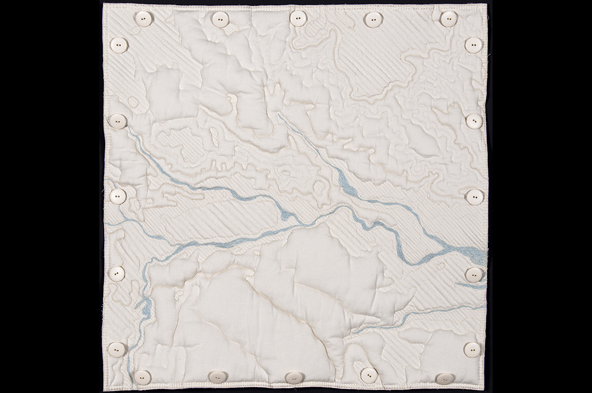
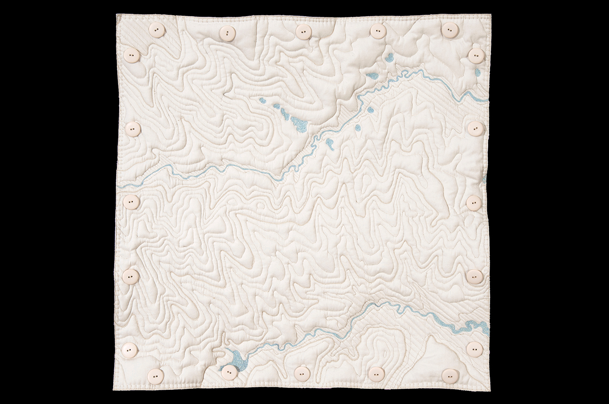
Dimensions: 24” x 24”
Materials: Machine embroidery and hand-stenciling on organic cotton, hemp and Tencel
Date: 2010
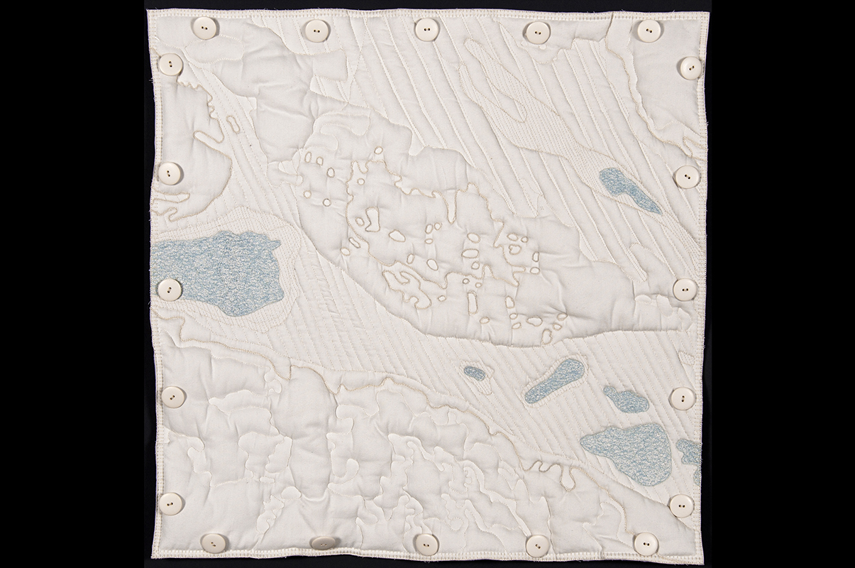
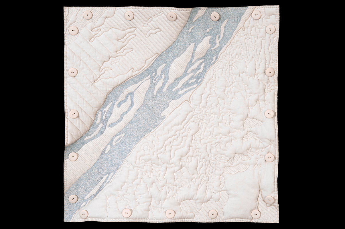
At the larger scale of the Terrain Squares, boundaries are lost and only topography remains, with heights and depths expressed as contour lines and padded relief forms. The only color on the front is the blue of the rivers, lakes and creeks.
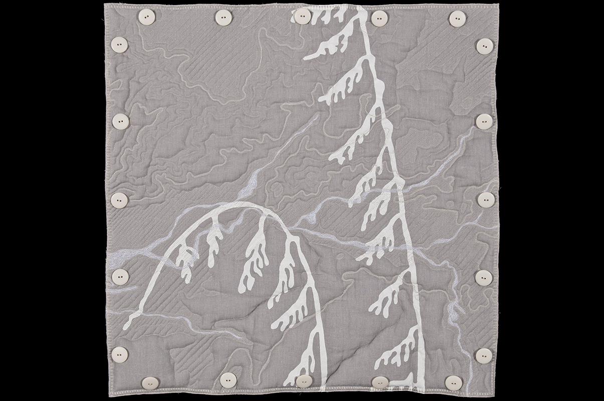
Dimensions: 24” x 24”
Materials: Machine embroidery and hand-stenciling on organic cotton, hemp and Tencel
Date: 2010
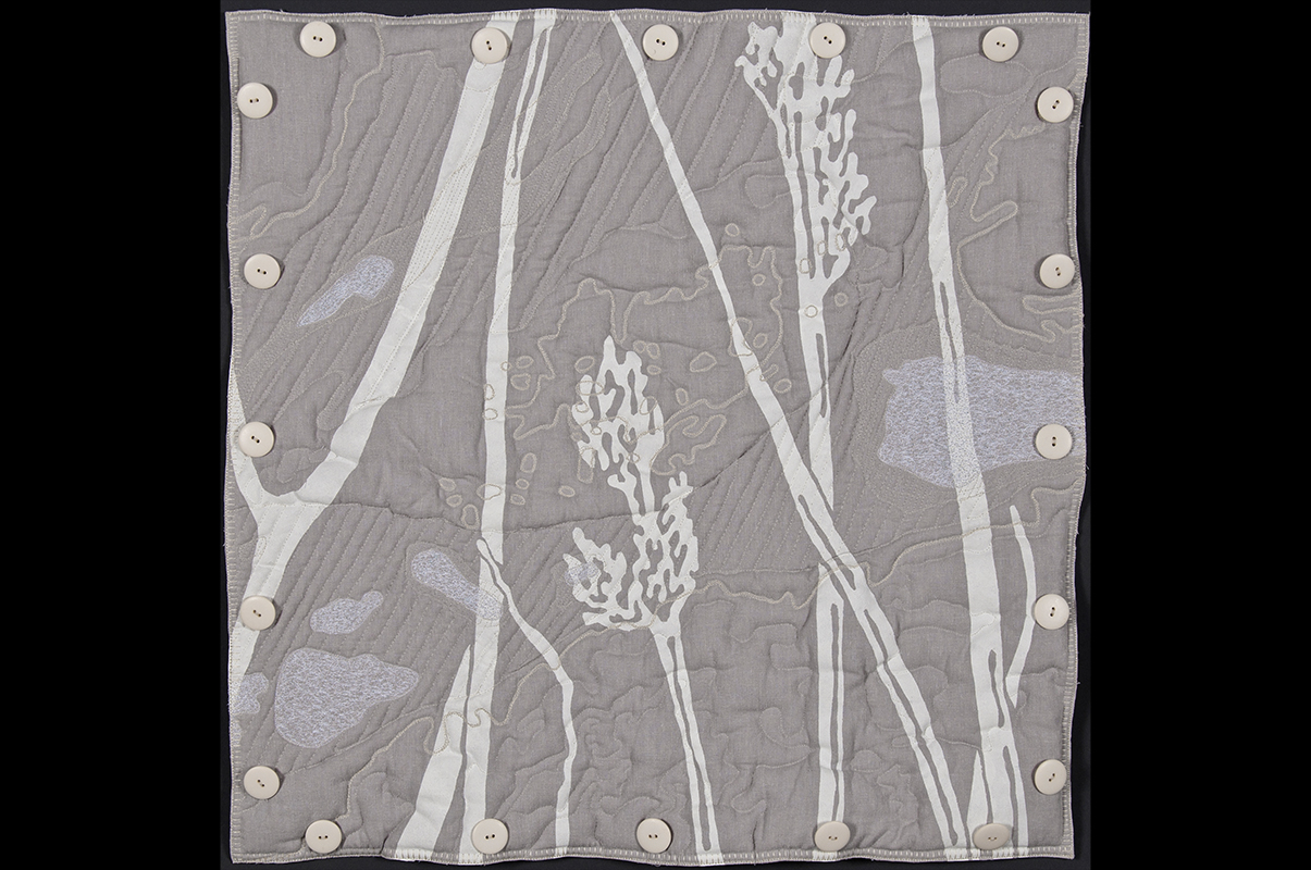
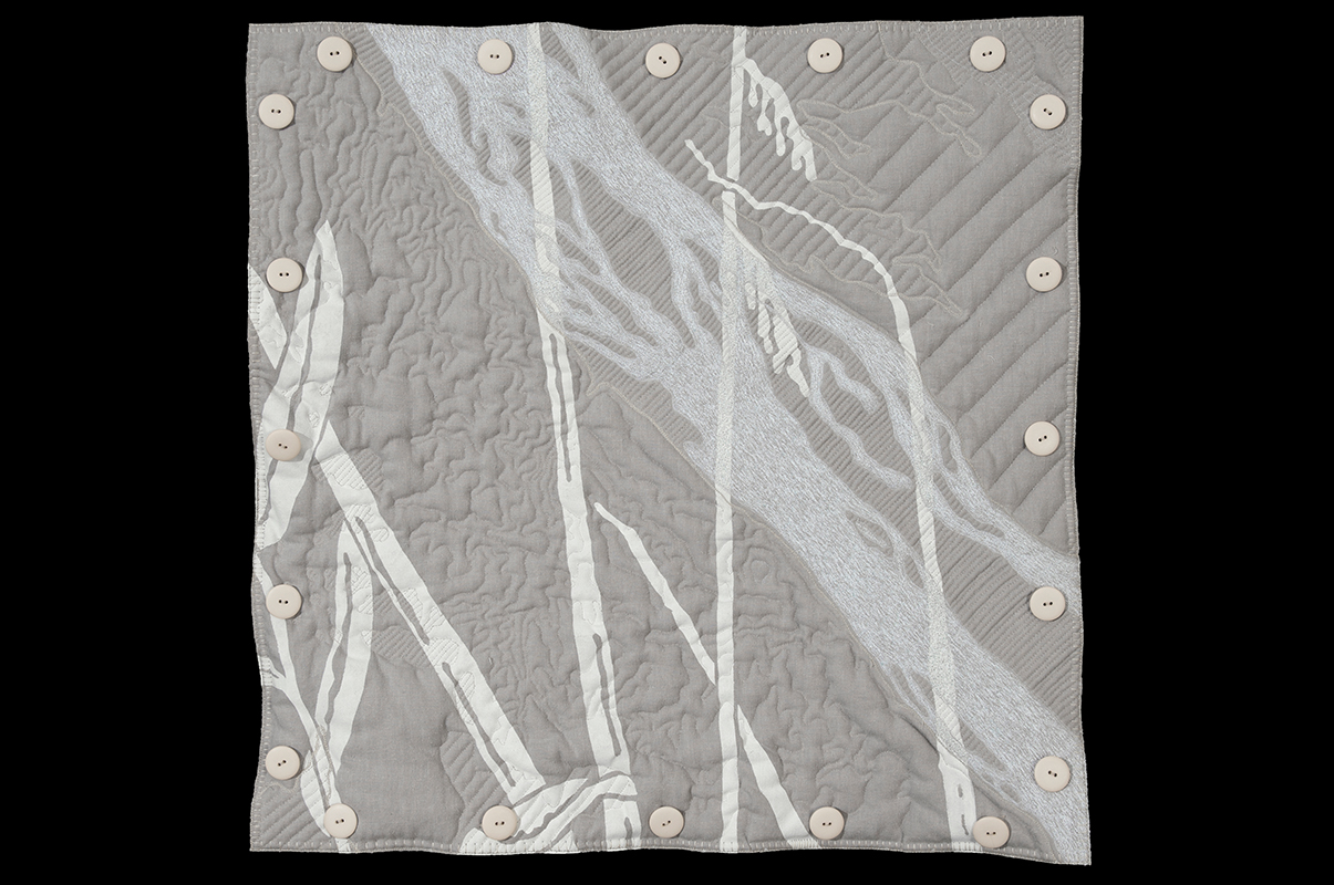
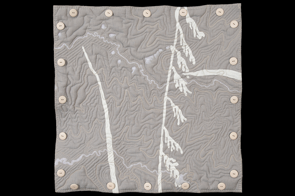
The back of each Terrain Square contains a hand-stenciled 24” fragment of my 8’ x 8’ graphic of Nebraska grasses, drawn much much [repeated word] larger than life size. The lakes and rivers, blue on the front of the Terrain Square, appear as white “ghost lakes” and ghost rivers” on the back and combine with the white stenciled “ghost grasses” in unexpected ways. A numbering system references which one of the sixteen squares of the grasses graphic is stenciled onto the back of each Terrain Square.
Dimensions: 24” x 24”
Materials: Machine embroidery and hand-stenciling on organic cotton, hemp and Tencel
Date: 2010
I stitch the Terrain Squares with the same vocabulary I use when drawing: contour lines, eccentric hatching and a sort of scumbling—decorative, but not too decorative—for the lakes and rivers. My stitched lines meander, losing course and then regaining it. They carve through the height of the quilted stuffing, containing and bounding it. Lakes and their surrounding land are subdued through hatching. When I stitch the blue water, the only patches of color in the squares, I imagine the actions of the wind on its surface and the effects of its currents on what lies underneath.
Dimensions: 24” x 24”
Materials: Machine embroidery and hand-stenciling on organic cotton, hemp and Tencel
Date: 2010
The stenciled “ghost grasses” on the backs of the Terrain Squares, filtered through memory and distant from botany, provide a vertical and organic counterpoint to the horizontal geometry of the quilted terrain.
Dimensions: 24” x 24”
Materials: Machine embroidery and hand-stenciling on organic cotton, hemp and Tencel
Date: 2014
Dimensions: 24” x 24”
Materials: Machine embroidery and hand-stenciling on organic cotton, hemp and Tencel
Date: 2014
Dimensions: 24” x 24”
Materials: Machine embroidery and hand-stenciling on organic cotton, hemp and Tencel
Date:2014
Dimensions: 24” x 24”
Materials: Machine embroidery and hand-stenciling on organic cotton, hemp and Tencel
Date: 2014
Dimensions: 7' x 11'
Materials: Cotton, rice paper, harem cloth; hand and machine embroidery
Date: 2017
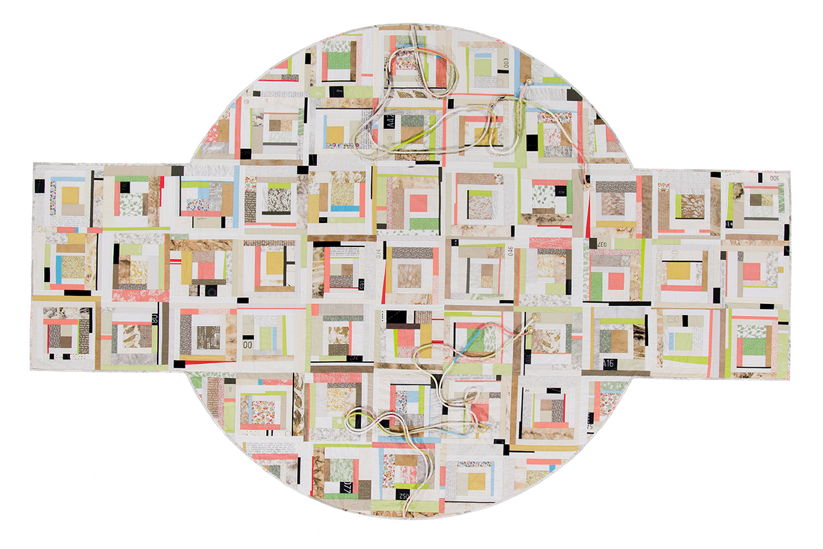
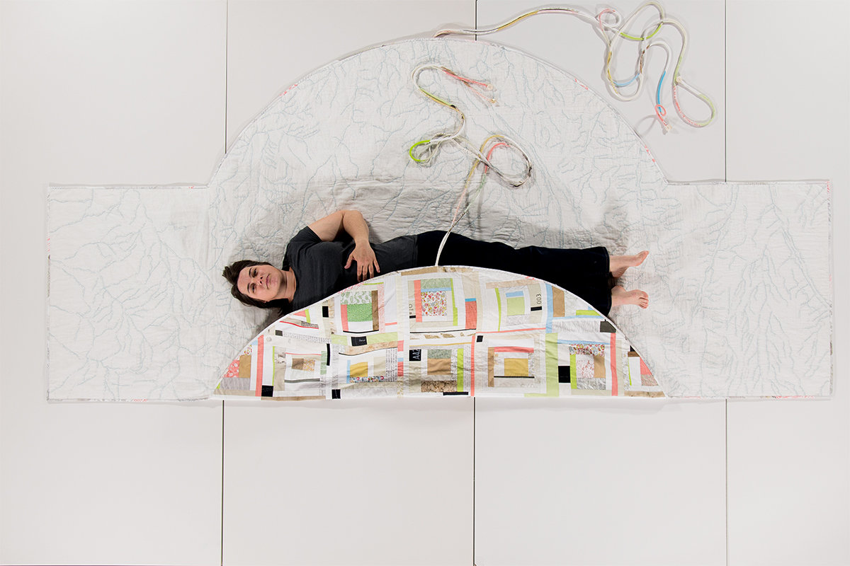
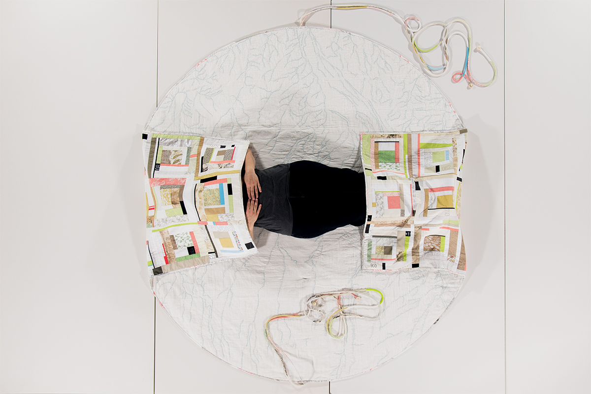
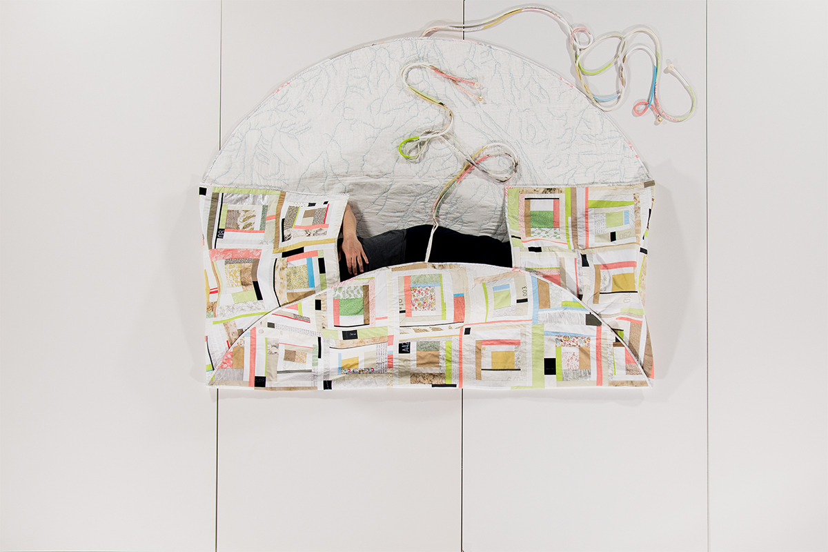
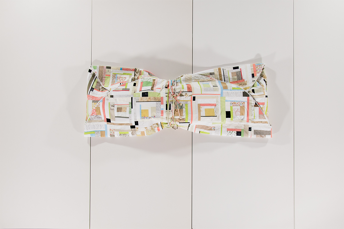
A pieced and quilted reversible construction functioning as map, memory, commentary and shelter.
Dimensions: 7' x 11'
Materials: Cotton, rice paper, harem cloth; hand and machine embroidery
Date: 2017
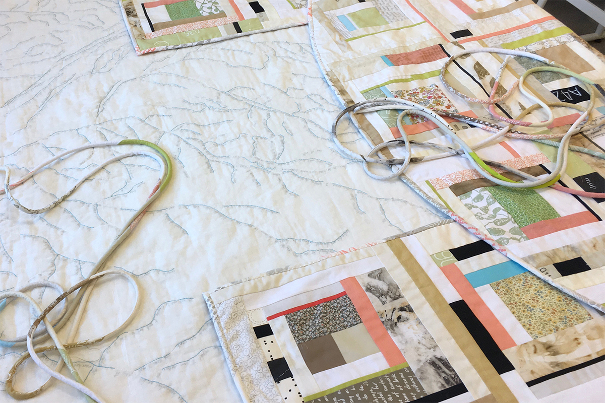
The interior is rice paper sandwiched between quilt batting and cotton gauze. The rice paper has tracings of the river system from my Nebraska map squares and the hand-written text contains snippets of my writing and quotes referencing the landscape, memory and loss.
Dimensions: 7' x 11'
Materials: Cotton, rice paper, harem cloth; hand and machine embroidery
Date: 2017
Designed to wrap a human, buttonholes allow four 10’ cords, with bone button embellishments, to wrap twice around the body.
Dimensions: 7' x 11'
Materials: Cotton, rice paper, harem cloth; hand and machine embroidery
Date: 2017
Dimensions: 7' x 11'
Materials: Cotton, rice paper, harem cloth; hand and machine embroidery
Date: 2017
Dimensions: 7' x 11'
Materials: Cotton, rice paper, harem cloth; hand and machine embroidery
Date: 2017
Dimensions: N/A
Materials: Cotton, rice paper, harem cloth; hand and machine embroidery
Date: 2011
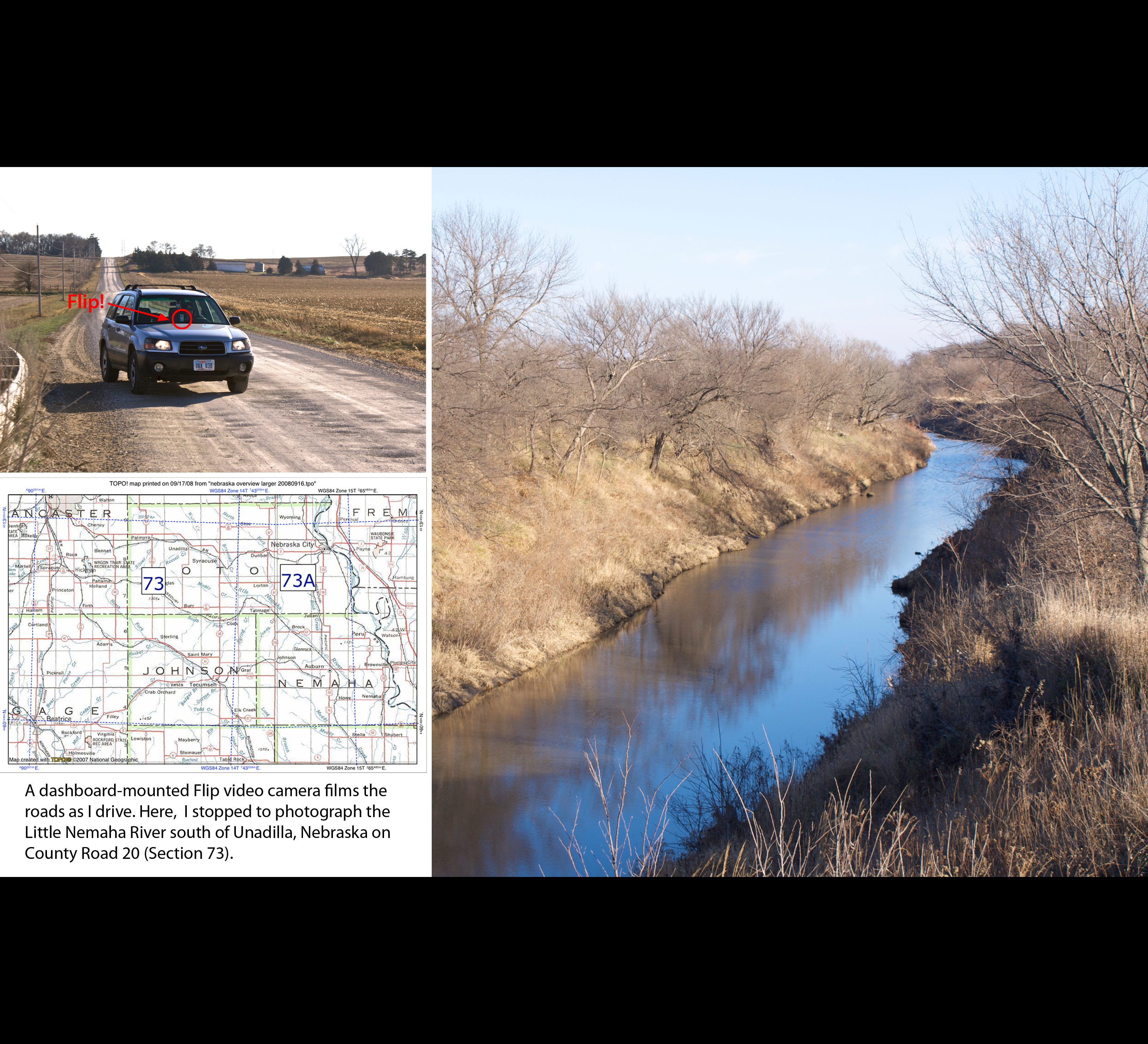
While drawing the Locator Map, I decided to constrast the abstract information gained by mapping with the sensory experience of being on the ground. I have traveled 9000 miles to date and documented my travels with still images and a dashboard-mounted video camera.
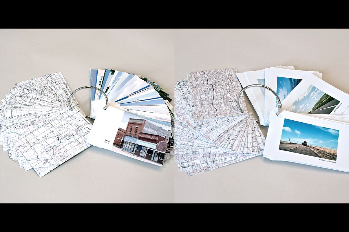
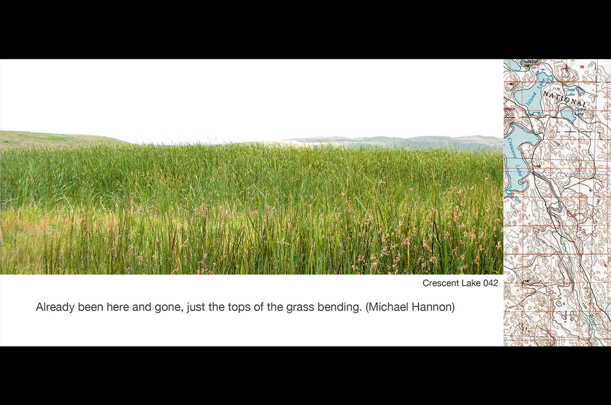
Dimensions: 4” x 6” cards
Materials: Inkjet printed photographs and topo maps
Date: 2011
Part of the Surveys component of Mapping Nebraska, these are collections of images of towns and other places and stills from my videos of Nebraska roads. The topo map for the particular location is printed on the back of each card.
Dimensions: 4" x 8.5” cards
Materials: Inkjet printed photographs and topo maps
Date: 2012
A collection of eleven images from my Surveys, combined with fragments of the topo map for that location. A portion of the hand-drawn Locator map at the same location is printed on the back of each card.
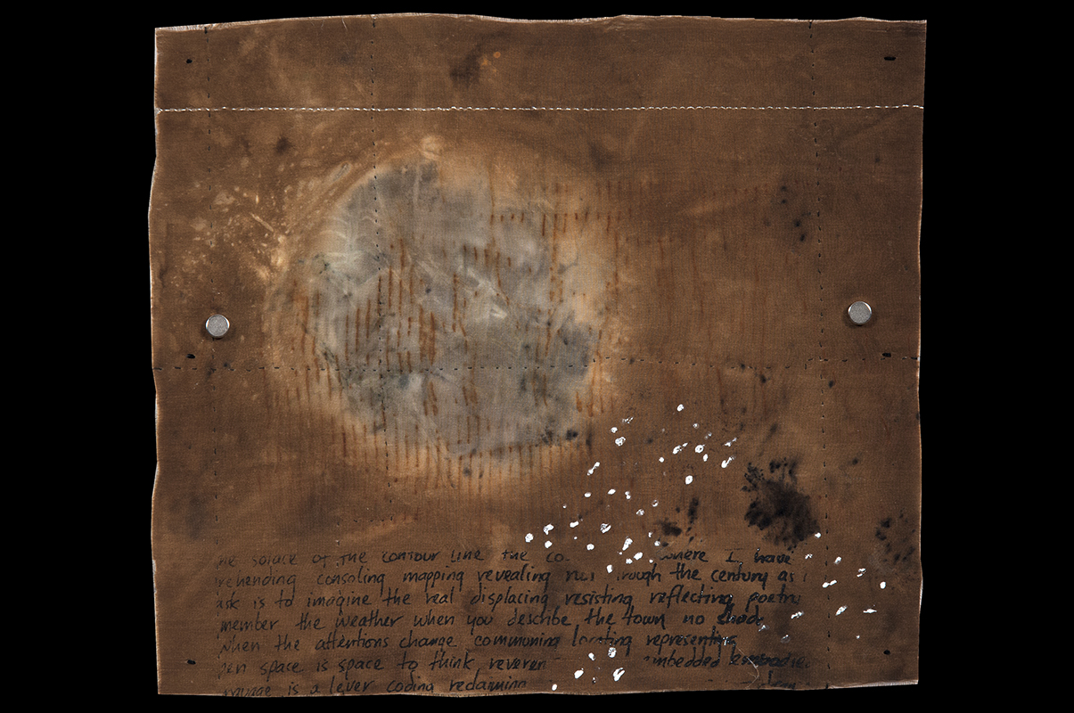
Dimensions: 10.75” x 12.25”
Materials: Stitching, foiling and printing on eco-printed silk (reversible)
Date: 2012
The location is the confluence of the Niobrara and Missouri Rivers.
Dimensions: 10.75” x 12.25”
Materials: Inkjet transfer of cotton gauze: rice paper with hand-stitching
Date: 2012
The back is rice paper covered with handwritten text and laminated to silk gauze onto which I transferred the topo map for this location.